

Photo Gallery: Meet a Mack Snowplow Built for Tough Alaskan Winter
How Alaska DOT Uses GPS for Precision Plowing
If snow plow drivers who work Alaska's Thompson Pass worried about driving in white-out conditions, the road would never get cleared. But thanks to an ultra-precise GPS system, these snow plow crews are able to get the work done.
April 18, 2019

A "Differential GPS" guidance system with 2-centimeter resolution keeps Alaskan snowplow drivers on the road even in zero-visibility white-out conditions.
Photos: Jim Park
7 min to read
Alaska's Richardson Highway links Valdez to the rest of the state. Closing the road isn't an option, even in the worst winter weather.
If snow plow drivers who work the road through Alaska's Thompson Pass worried about driving in zero-visibility white-out conditions, the road would never get cleared. During the average winter over the past 50 years, the Thompson Pass on the Richardson Highway near Valdez receives about 500 inches (1,270 cm) of snow. The area claims several snowfall records: in 1955 a single-day accumulation record was set of 62 inches (160 cm), and during the winter of 1952-1953, a record 971.1 inches (2,474 cm) landed in the area.
It snows a lot through Thompson Pass, yet the snow plow crews there can keep running thanks an ultra-precise GPS system that's accurate to within two centimeters, or less than one inch.
"In the US, the paint stripe on a highway lane is four inches wide, so this GPS is accurate enough to know when the wheel is going over the inside of the line," says Craig Shankwitz, PhD, one of the system's original development team from the University of Minnesota.
For snow plow drivers like Mark Hanson of the DOT station at Thompson Pass, it means the difference between driving blind through a blizzard and still knowing exactly where the truck is on the road even when everything out front is just a white blur.
"These trucks are all set up with differential GPS systems, a guidance system for getting you a virtual image of where you are on the road," Hanson says. "It's a really good way of keeping you on the road. Not only does that make it so that you have that confidence of knowing you're not on the wrong side of the road while you're plowing, it keeps you from, kind of like I call it, pin-balling or serpentine down the road. You can cut a really nice true straight line down through a whiteout and that way, you have less passes to get the road the full width."
In the cab, drivers have a display that shows the truck's position relative to the lane markings on a moving map. The center-line appears as a yellow dashed line, while the outer lane markings appear as solid white lines. If the truck travels over the lane marking, a solid red line appears warning the driver he or she is crossing out of the prescribed lane.
In addition to the in-cab display, there are motorized vibrators in the driver's seat that activate if the truck crosses out of the lane. If they cross over the center line -- drifting left -- a vibrator in the left side of the seat goes off. Drift to the right toward the shoulder, and the right-side vibrator goes off. It's a natural human reaction to move away from something you don't expect, so almost subconsciously the driver steers away from the source of the vibration, thus centering the truck in the lane.
The displays are of such resolution that drivers, with a little practice, can steer the plows along the winding roadway using just the image on the display. As well as the GPS, the plows are equipped with forward-looking radar to warn of objects in the road, such as abandoned cars.
Systems were first installed in snow plows by the Alaska DOT in 2003. The technology is ancient by today's standards, but it remains state of the art since nothing better has ever come along.
The main technology is called Dual Frequency Carrier Phase GPS, says Shankwitz. It uses signals from two separate networks of satellites, the civilian signals from the American GPS satellite constellation, and in the case of the Alaskan snow plows, signals from the Russian GPS constellation of satellites called GLONASS, or Global Navigation Satellite System.
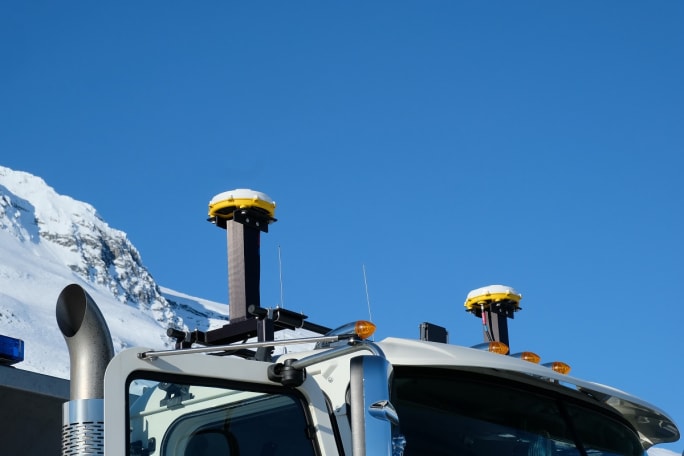
Two roof-mounted GPS receivers guide the trucks by tuning into two separate GPS satellite constellations, the public side of the US military GPS and the Russian GLONASS.
The trucks have two GPS receivers mounted atop the cab. These receivers cost about $10,000 each, Shankwitz says. "That's probably why this hasn't been deployed in many other areas; it's just too expensive and most applications do not require that level of accuracy."
The two-centimeter accuracy actually comes from a third receiver -- a high-precision, stationary ground-based receiver perched atop a microwave communications tower in nearby Valdez. It's accurate to within millimeters and it acts as reference receiver for the plow-mounted systems.
"The receiver the base station is essentially looking at the code and then counting the number of wavelengths coming from each of the satellites to the antenna," Shankwitz says. "The difference between the wavelengths is about two centimeters so when we talk about that two-centimeter accuracy, it's actually the possible variance you have in the number of wavelengths that get to that satellite. It counts the number of wavelengths from a couple of satellites in geosynchronous orbit 26,000 kilometers above the earth."
The base station computes the error from where it knows the stationary GPS receiver is, to where the truck-mounted GPS thinks it is. The system calculates the error and sends that information to the trucks via VHF radio. Computers on the trucks use the derivation correction to correct the actual position of the trucks on the ground to within two centimeters. And all that happens thousands of times every second.
While the system we described is quite expensive, too expensive really for any application that doesn't required a very high level of accuracy, in the case of the Alaska snow plows, they have to consider the cost of getting overwhelmed by a storm.
"Look at just the labor costs; those guys work twelve hour shifts and basically stay at the truck station when the weather is bad," says Shankwitz. "If they're there not plowing snow, they're basically being paid to not work because they can't work. Whereas if you think about productivity, they can go out there in absolute zero visibility and work to keep the road open. Even if the road is closed, once the weather clears people don't have to wait for the plows to come out during higher visibility times when they could operate without the system."
The city of Minneapolis currently uses a newer version of this system on some transit buses that operate on the shoulders of the road around the Twin Cities. When it snows heavily and the operator can't see where the shoulder is, they can still see their position on the shoulder using a display similar to what is on the Thompson Pass snow plows -- except these use the cellular network to transmit the derivation correction to the bus rather than a VHF radio.

Plow driver Mark Hanson has worked at the Thompson Pass DOT station near Valdez, Alaska for 22 years. He says the Richardson Highway has to kept open even in the worst weather, and the differential GPS makes that possible.
GPS and Autonomous Vehicles
GPS with such accuracy seems like the perfect navigation solution for autonomous vehicles. But the system described above, developed by MTS and the University of Minnesota, is patent- protected for a couple more years. Not that it matters much, though. The U.S. government is about to bring on line a new constellation of GPS satellites called GPS III.
"Instead of two frequencies on GPS that we use now, civilian and military, GPS III will give a third frequency -- when the constellation is fully populated," says Shankwitz. "When that happens, we'll have 10-centimeter accuracy rather than two, but without the high cost of the patent and the infrastructure from the base station that supports the operation in Alaska and other places. All of a sudden the cost comes way down, and GPS technology becomes much more viable."
Many of the autonomous vehicles now in development use a combination of Radar (collision avoidance) and Lidar to see their way in the world. GPS is used as well, but for navigation rather than lane management. GPS III could bring to autonomous vehicles the kind of precision "vision" the snowplows clearing Thompson Pass in Valdez, Alaska enjoy now. But there's still one more thing needed to make it work: the map database.
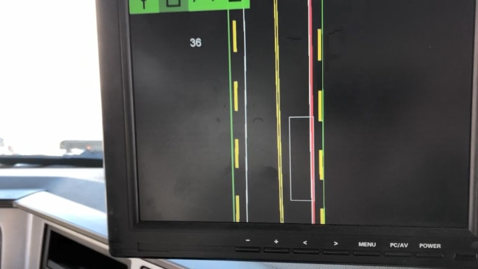
In the cab, drivers have a display that shows the truck's position relative to the lane markings on a moving map. The center-line appears as a double yellow dashed line, while the outer lane markings appear as solid white lines. The white rectangular box is a scale representation of the truck. The solid green line represents the guardrails. If the truck crosses over the lane marking, a solid red line appears warning the driver he or she is crossing out of the prescribed lane.
"Google has mapped much of the planet to very accurate dimensions, in fact they've got map database technology that really no one else has, explains Shankwitz. "So, when that GPS III constellation becomes populated, the GPS receivers, instead of being an expensive instrument, basically become a commodity. That's when Google goes nuts and owns the entire planet."
To prevent Google from having global exclusivity on high-definition mapping, a consortium of German automakers, including Audi, Volkswagen, Daimler and BMW have bought former mapping provider, NAVTEQ's, database from Nokia for US $3 Billion in 2017, the New York Times reported. "The Germans realized that GPS III is coming and a ten-centimeter accuracy that is sufficient to guide an autonomous vehicle," said Shankwitz.
"GPS solves the weather sensitivity problem that we now have with image-based systems, and you combine that with the map database, you've got the guidance thing covered," he adds. And as Radar and Lidar technology evolve, you add that for collision avoidance, you've got all the elements you need for a functional, all-weather, autonomous vehicle."
And it all started with a couple of snow plows in Alaska.
Subscribe to Our Newsletter
More Safety & Compliance

Brake Safety Week to Focus on Drums and Rotors
Commercial vehicle inspectors will be focusing on brakes during CVSA's Brake Safety Week, August 23-29.
Read More →
Trump Administration Looks to Put More Veterans Behind the Wheel
The Freedom Haulers program pulls together existing and expanded programs at several federal agencies to recruit veterans to drive commercial heavy-duty trucks and cut the red tape for them to get a CDL, training, and employment.
Read More →
$604 Million Verdict Tests Broker Liability After Supreme Court Ruling
C.H. Robinson plans to appeal after a Texas jury found it bore the largest share of responsibility for a fatal 2021 crash, in a case that follows the Supreme Court's Montgomery decision allowing negligent hiring claims against freight brokers.
Read More →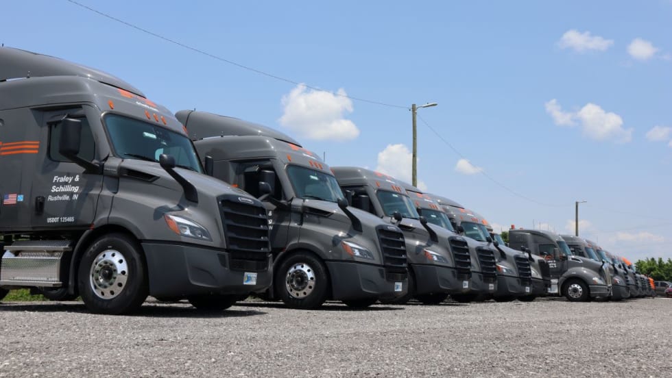
How Fraley & Schilling Improved Logbook Compliance by Over 50%
Fraley & Schilling needed a way to close a compliance workflow gap in its ELD system without adding more work from driver training, reminders, and back-office follow-ups. It found the answer in a custom driver app.
Read More →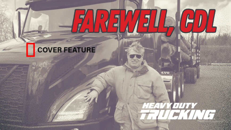
Farewell, CDL: Why I'm Giving Up My Commercial Driver's License
After more than 20 years as a CDL holder, HDT Executive Editor Jack Roberts is letting his commercial license expire. Not because he wants to — but because trucking's nuclear verdict crisis has made the risks of public-road test drives too great for editors, manufacturers, and everyone involved.
Read More →
Enhance Fleet Performance with High-Efficiency Auxiliary Power Units
Drive sustainable cost savings while increasing driver comfort during short- and long-haul logistics operations.
Read More →
Wabash Trailers Recalled for Improperly Installed Underride Guards
More than 900 Wabash dry van trailers may not comply with the Federal Motor Vehicle Safety Standard for rear impact guards.
Read More →
Why K&B Trucking Is Embracing AI and Driver Safety Technology
Crunching data and embracing artificial intelligence are key in K&B Trucking's safety efforts, says the company's safety director.
Read More →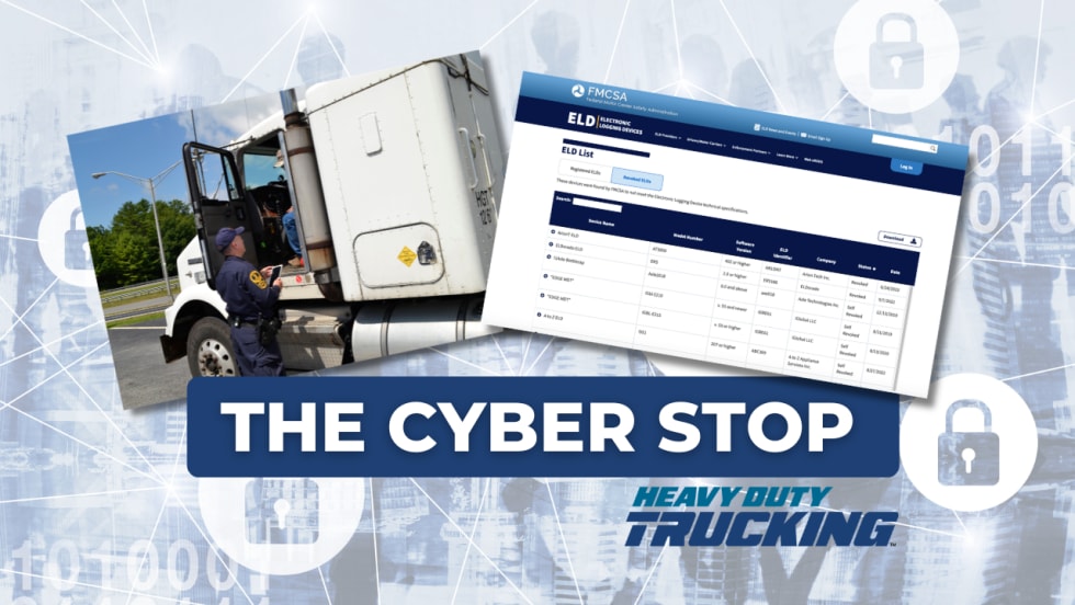
The Hidden Problem Behind FMCSA's ELD Revocations
NMFTA researchers say dozens of registered ELDs may be built on the same software platforms, allowing compliance and security concerns to persist even after individual devices are removed from the market.
Read More →
ATRI Wants Motor Carriers for Driver-Facing Camera Study
In this new study, the American Transportation Research Institute will explore how driver-facing cameras can impact safety and operational metrics in trucking fleets.
Read More →