

ALK Releases Enhanced Version of ALK Maps
ALK Technologies has released version 1.2 of its ALK Maps interactive visualization platform.
ALK Technologies has released version 1.2 of its ALK Maps interactive visualization platform.
The new version includes some advancements for improving visual interactivity and adds additional customization options for customers.
ALK Maps version 1.2 includes:
Satellite imagery from MapBox with a street network overlay for faster, higher resolution performance
Spherical Mercator as the default mapping projection, bringing it in line with industry standards
Street-level zoom with or without satellite view
Clustering of point features based on user rules and attributions
Ability to create geodesic polygons
Options to customize color and opacity of route lines on the map based on preference
A complete list of changes for version 1.2 can be found on the developer portal.
ALK Maps is a fully customizable cloud-based interactive mapping platform with high quality visualization, precise geocoding and routing functionality.
More Products

Aperia’s Halo Connect Expands to Last-Mile Segment
Aperia Technologies extended its reach into the last-mile segment with its Halo Connect Predictive Tire Maintenance Platform, for heavy-, medium-, and light-duty commercial vehicle applications.
Read More →ERoad Offers Asset Tracking Solution
ERoad has launched the ERoad Asset Tracker, a weatherproof product that tracks trailes, equipment and other powered assets on the same platform that customers use to manage their fleet.
Read More →
Updated DocumentPower Enterprise Features Free Remote Image Capture
McLeod Software has released Version 19 of DocumentPower Enterprise, which includes a free version of its Mobile Capture App for mobile devices.
Read More →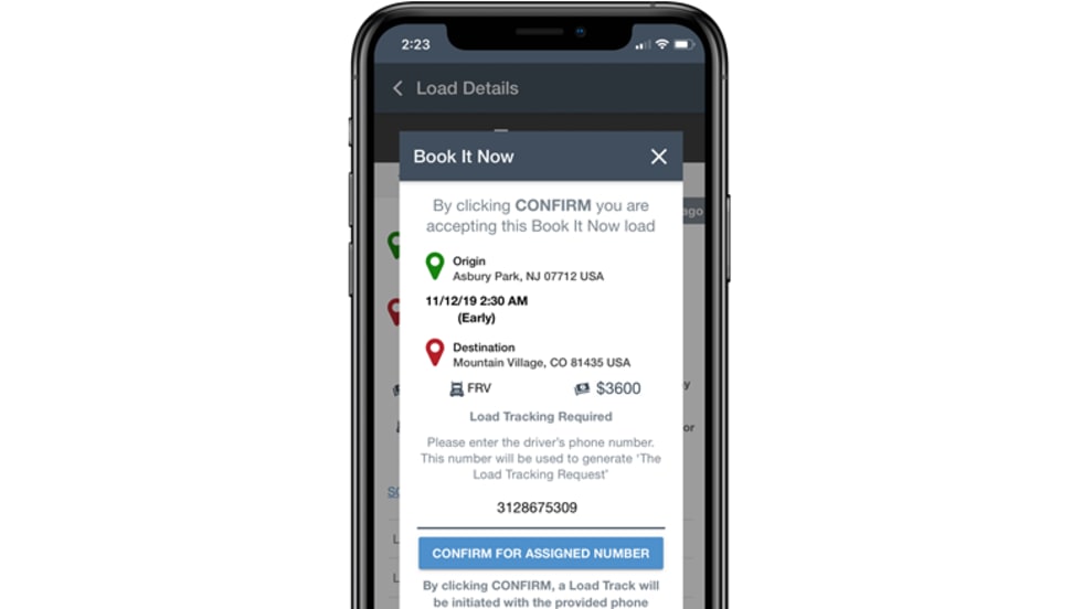
Truckstop.com Freight Marketplace Features Instant Booking
The Book It Now feature allows freight brokers and 3PLs of any size to add instant load booking functionality to their business and carriers will be able to see Book It Now loads from freight brokers they know on Truckstop Mobile.
Read More →
Trimble Duo Combines Fleet Mobility Capabilities Into a Single Device
The Trimble Duo is an Android-powered device that combines an in-cab display with 4G-LTE connectivity to offer fleets an all-in-one solution for fleet mobility.
Read More →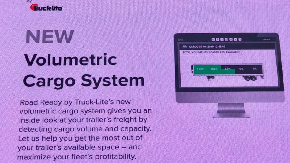
Truck-Lite Adds Volumetric Cargo System to Road Ready Telematics Suite
The system works by dividing a trailer into zones, depending on its size, and employing up to five cargo sensors that report how much freight is loaded into each zone, allowing fleets to see if there is any cargo space that is not being used.
Read More →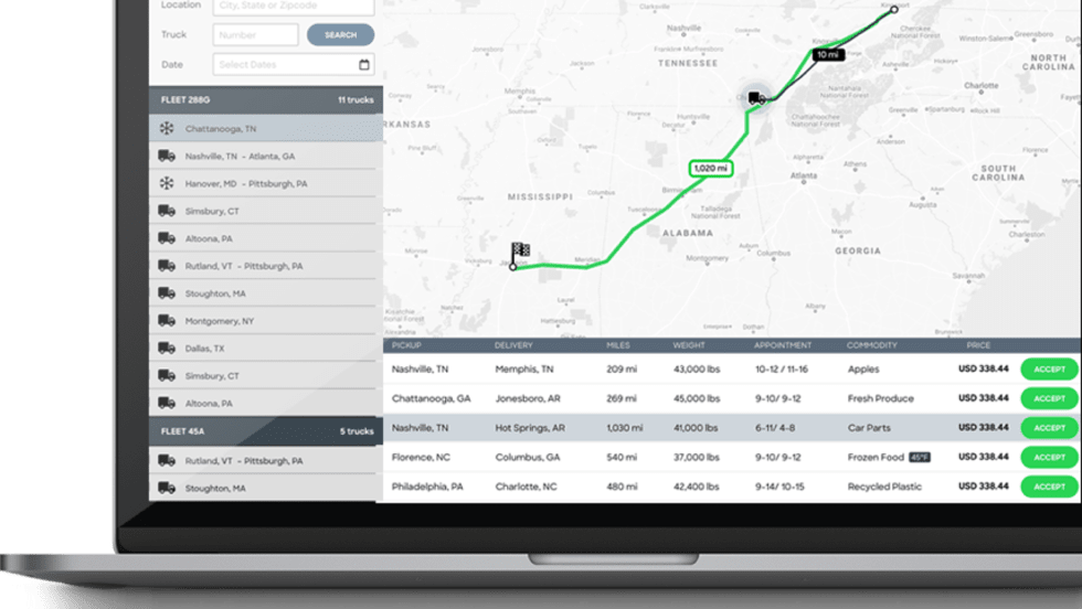
Loadsmart SmartMatch Tool Helps Carriers Find Optimal Freight
Freight technology company Loadsmart has launched the Smart Match tool, which provides carriers an efficient way to find the best available loads.
Read More →
Comdata OneLook Helps Fleets Track Important Metrics
Comdata has launched Comdata OneLook, a business intelligence solution that provides fleet managers with more strategic and actionable analytics from a Comdata Fuel Card.
Read More →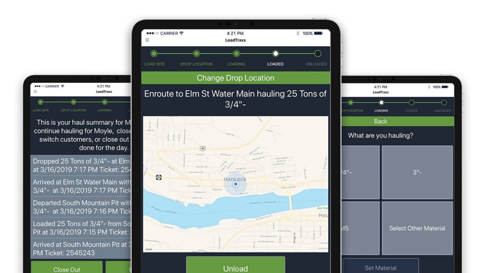
LoadTraxx App Helps Short Haul Fleets Track Loads and Billing
The LoadTraxx app allows short haul truck drivers to log their materials, enter load weights, select loading and unloading locations and set customers.
Read More →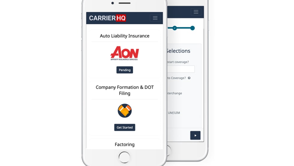
Aon Offers Adjustable Rate Insurance to Small Fleets
Aon has launched a monthly motor carrier insurance program for fleets with 20 or fewer vehicles that uses data collected from electronic logging devices to determine rates.
Read More →